Climbing Mount Kinabalu: Complete Trekking Guide
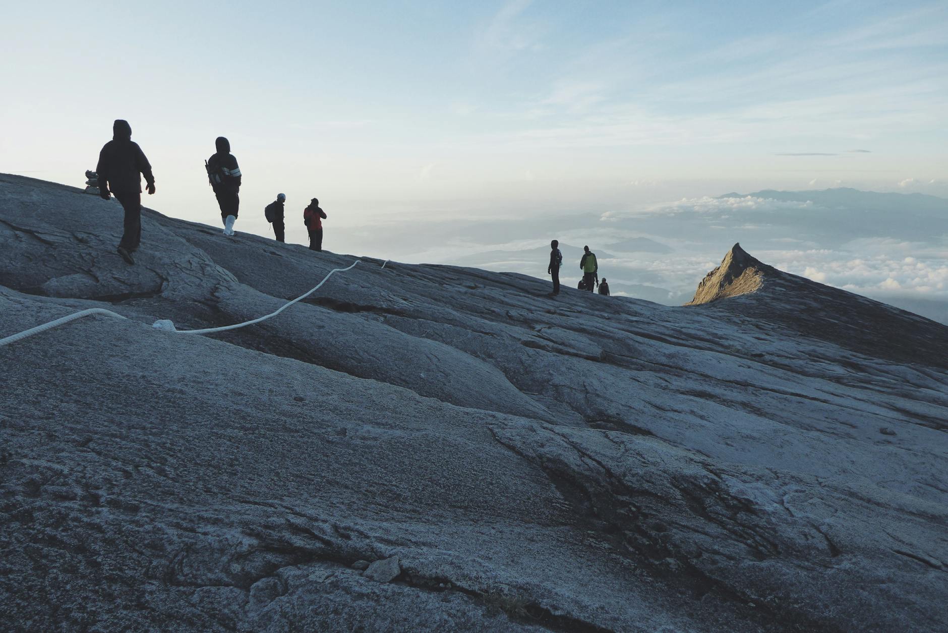
At 4,095 metres, Mount Kinabalu is the highest point between the Himalayas and New Guinea. It dominates the interior of Sabah — Borneo’s northern state — and on a clear morning you can see it from the plane as you descend into Kota Kinabalu: a massive granite dome rising out of the cloud, unmistakably larger than anything around it. The mountain draws climbers from across the world not because it requires technical skill, but because it delivers one of the most compressed and rewarding adventure experiences in Southeast Asia. Two days. A 2 AM start. A sunrise at 4,095 metres over Borneo. It’s the kind of thing you plan a trip around.
This guide covers everything you need to actually plan the climb: permits, exact costs in MYR, fitness requirements, day-by-day trail conditions, what to pack, the via ferrata option, and how Kinabalu fits into a broader malaysia adventure travel itinerary. If you’re also spending time on the Sabah coast, our guide to scuba diving malaysia covers the Sipadan and east coast dive sites that pair naturally with a Kinabalu trip.
Kinabalu Park: UNESCO World Heritage Site
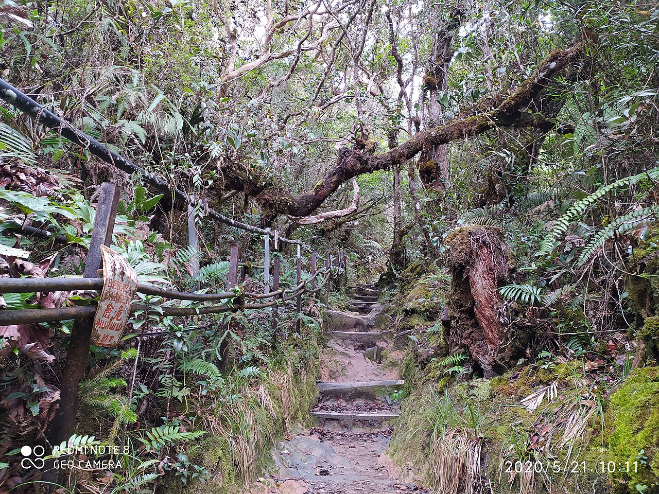
The mountain sits inside Kinabalu Park — 754 square kilometres of protected land that became Malaysia’s first UNESCO World Heritage Site in 2000. The designation was for biodiversity, and the numbers behind it are genuinely staggering. The park contains an estimated 5,000 to 6,000 vascular plant species, representing more than half the known flowering plant families on Earth concentrated in a single location. Over 800 orchid species grow here. More fern species live in this one park than across the entire continent of Africa. At least ten species of Nepenthes pitcher plants grow on the mountain, four found nowhere else on Earth. The rafflesia — one of the world’s largest flowers — blooms here, its giant red blooms reaching up to 170 centimetres in diameter.
The fauna is equally impressive. Kinabalu Park records 326 bird species including the rhinoceros hornbill, the mountain serpent-eagle, and the Bornean spiderhunter — a pure endemic found only on this mountain. Ninety lowland and 22 montane mammal species also live here. As you climb from Timpohon Gate to Low’s Peak, you pass through several distinct ecological zones: tropical lowland rainforest, cloud forest draped in mosses and epiphytes, sub-alpine scrub, and finally bare granite summit terrain. It is one of the most compressed ecological gradients in the tropics, and the transitions happen fast enough that you can feel them as you gain altitude.
The Kinabalu National Park headquarters area is worth a day in its own right even if you are not climbing — the botanical gardens, lower trails, and canopy walkways showcase the biodiversity without the altitude demands of the summit route. Non-climbers in a group often spend the day exploring here while others summit, and it is a genuinely rewarding option.
Permits, Booking, and Costs
Permit Requirements
A climbing permit issued by Sabah Parks is compulsory for all climbers and must be worn visibly throughout the ascent and descent. Sabah Parks caps the mountain at 163 climbers per day to protect the environment and manage safety at the overnight base camp. That daily cap is the reason permits sell out so far in advance — popular dates during Malaysian school holidays and the dry season from March to September disappear within hours of the annual booking window opening. A certified mountain guide is also mandatory, not optional, and is included in all package bookings.
How to Book
Permits are sold through the official Sabapak Eco Holding booking system, or bundled into all-inclusive climbing packages through licensed Kota Kinabalu tour operators. For international visitors, packages are almost always the more practical route — they handle permits, guide fees, park entrance, Laban Rata accommodation, meals, and return transport from Kota Kinabalu as a single transaction. Book at least three to four months ahead for standard dates; six months or more for peak school holiday and dry-season windows. Cancellations are non-refundable and name transfers between climbers are not permitted by Sabah Parks, so only commit once your travel dates are firm.
Cost Breakdown
The climb permit alone is RM100 for Malaysian citizens and RM400 (approximately USD 85) for international visitors. But the permit is only one line item. Mandatory guide fees, park entrance, overnight accommodation at Panalaban, meals (dinner and pre-dawn breakfast), and insurance all add to the total.
All-inclusive two-day, one-night packages for international visitors typically run RM2,690 to RM2,890 per person depending on operator and group size. Malaysian citizens pay RM1,740 to RM1,940. Budget three-day, two-night packages that add an acclimatisation night in nearby Kundasang start from around RM1,390. Via ferrata packages — summit climb plus cable-assisted descent route — start from approximately RM7,280 per person. Accommodation tier at Panalaban affects the final price; private rooms cost more than dormitory beds and fill faster.
Preparing for the Climb
Physical Fitness
No technical mountaineering is required for the standard route. What it does demand is sustained cardiovascular output over a long day followed by a sleep-deprived early morning push. You gain over 2,200 metres in elevation across nine kilometres of trail, much of it steep stone steps — roughly equivalent to climbing 600 flights of stairs. That is a meaningful physical effort for most people.
A four-to-six-week preparation window is realistic for people who are not already hiking regularly. In the first two weeks: leg-focused strength work twice a week — squats, step-ups, lunges, single-leg exercises — combined with thirty to sixty minutes of running or brisk walking three times a week. In the final two to three weeks: shift to loaded hikes of sixty minutes or more with an eight-kilogram pack on hilly terrain, which mimics the actual climb conditions closely. In cities without hills, stair climbing in a tall building — ten to twenty floors repeated — gets you surprisingly close to trail-specific fitness. People who arrive at Kinabalu without preparation describe the last two kilometres to Panalaban as demoralising; people who prepare adequately describe the same section as hard but manageable.
One practical note: the descent is equally demanding on the legs, often more so than the ascent because of the sustained downhill load on knees and quadriceps. Any preparation that works the legs eccentrically — step-downs, downhill hiking, cycling — pays dividends on day two.
Altitude Sickness
Acute Mountain Sickness can affect anyone at altitude regardless of fitness, age, or previous high-altitude experience. Symptoms — headache, nausea, dizziness, fatigue, loss of appetite — typically appear within six to twelve hours of reaching elevation. On Kinabalu, you ascend from 1,866 metres to 4,095 metres in under twenty-four hours, which is a rapid gain by any standard.
The best mitigation: arrive in Kundasang or at Kinabalu Park headquarters at around 1,500 metres a day or two before your climb date, giving your body time to begin adjusting. On the climb itself, ascend at a slow and steady pace and take extended rest breaks — ten minutes or more — at the fourth and fifth kilometre markers during the steepest section. Drink two to three litres of water during day one; dehydration significantly worsens AMS symptoms. Some climbers use Acetazolamide (brand name Diamox) to assist acclimatisation — consult a doctor before the trip, as this is a prescription medication in most countries and carries its own side effects. If you experience severe symptoms — confusion, inability to walk in a straight line, persistent vomiting, severe headache unrelieved by paracetamol — tell your guide immediately. Descent is the only reliable treatment for serious AMS, and your guide is trained to make that call.
What to Pack
Clothing: Layer for multiple climate zones. Moisture-wicking base layers for the warm lower trail. A warm fleece or insulated jacket for Laban Rata, where temperatures run 8 to 15 degrees Celsius. A waterproof, windproof outer shell for the summit zone, where temperatures can drop to zero degrees or below before dawn with additional wind chill. Gloves and a warm hat or balaclava are essential — the fixed-rope section above Sayat-Sayat in the pre-dawn dark and cold is where underprepared climbers suffer most. Quick-dry trekking trousers and multiple pairs of warm hiking socks complete the clothing kit.
Footwear: Sturdy hiking boots with solid ankle support and reliable grip. The granite slabs on the summit section are slippery when wet, and the steep stone steps on the lower trail demand proper boots rather than trail runners. Break them in before you arrive — blisters on day one of a two-day mountain climb have derailed many Kinabalu attempts.
Equipment: A quality headlamp with fresh batteries is non-negotiable for the 2 AM summit push — you will be climbing in complete darkness for two or more hours. Trekking poles are available to rent at park headquarters for around RM45 per pole and reduce knee strain significantly on the descent; they are worth the rental fee. A rain poncho or pack cover protects against sudden downpours on the lower trail. Bedding is provided at Panalaban, so a sleeping bag is not needed unless you prefer your own.
Food: Base camp provides buffet dinner and a pre-dawn breakfast before the summit push. Bring your own energy snacks — trail mix, energy bars, dried fruit, chocolate — for the summit push and the long descent. Eating something at 2 AM before setting off matters more than most people expect; cold and altitude together increase caloric demand and a small meal makes a real difference to your energy on the granite slabs.
Other essentials: Sunscreen and sunglasses for the summit — light reflects strongly off granite at altitude. A reusable water bottle saves money since water sold at altitude is expensive. A waterproof case for your phone and spare batteries kept in inner pockets close to your body to preserve charge in the cold.
The Climb: Day by Day
Day One: Timpohon Gate to Panalaban
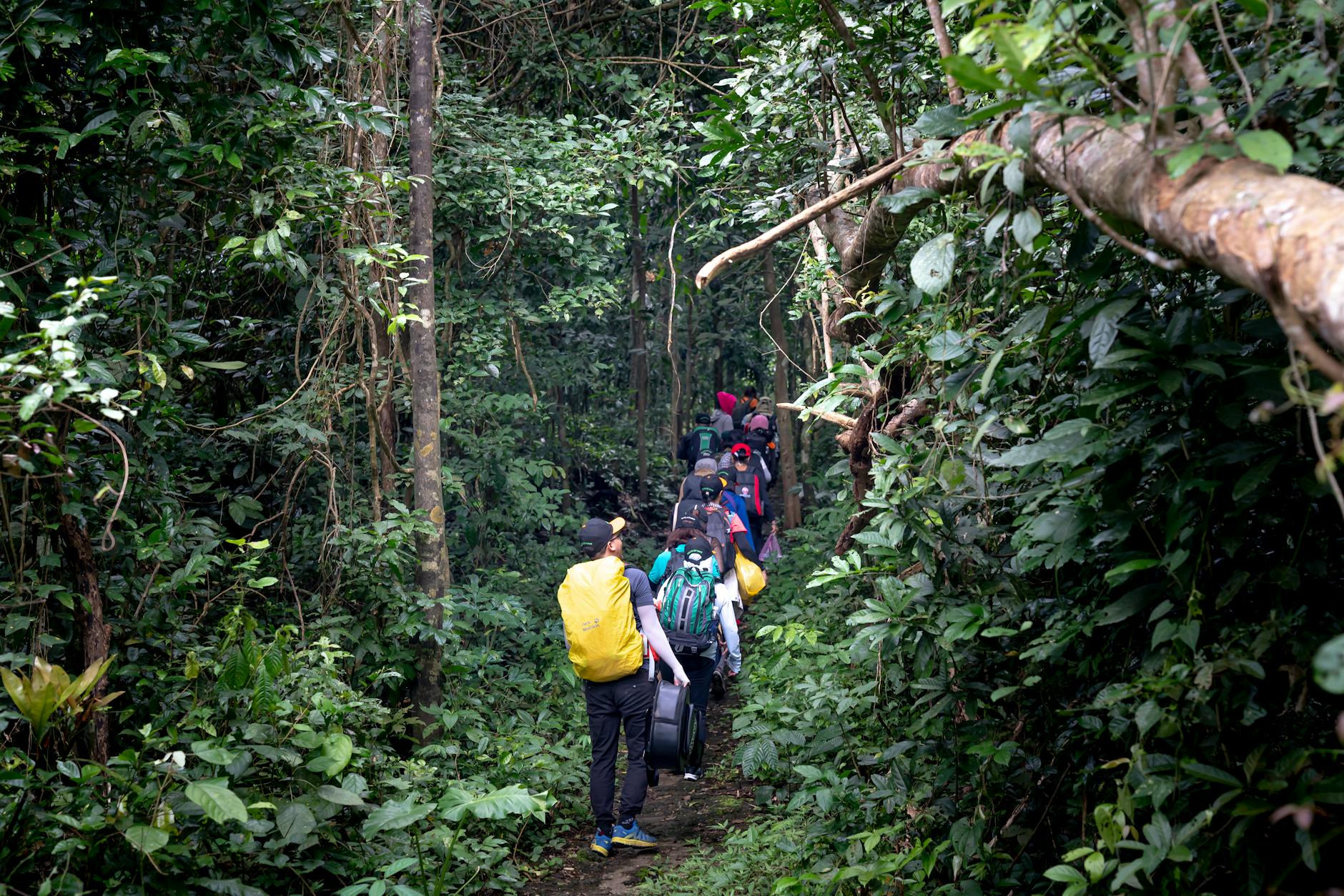
The day starts at Kinabalu Park headquarters with registration, a safety briefing, and an introduction to your assigned mountain guide. A short shuttle delivers you to Timpohon Gate at 1,866 metres — the official trailhead. From here, the climb covers approximately six kilometres and 1,400 metres of elevation gain to Panalaban base camp at around 3,270 metres. Most climbers take four to seven hours depending on pace and fitness.
The lower trail runs through rich tropical montane forest. Ferns, orchids, and pitcher plants line the path; the canopy towers overhead. Numbered kilometre markers and rest shelters with basic toilet facilities appear at regular intervals. The surface is mostly packed earth, wooden boardwalks, and stone steps, with some scrambling over tree roots and rocks. The first kilometre is deceptively moderate. The gradient steepens noticeably from around kilometre two and stays steep for most of the remaining distance to base camp.
The forest transitions as you gain altitude. Tall dipterocarps give way to stunted, mossy cloud forest around the three to four kilometre mark. Every surface here — rocks, roots, branches, fallen logs — is carpeted in dense green moss and hanging lichens. The light changes too, becoming diffuse and cool. This mossy zone is one of the most distinctive and atmospheric sections of the climb and worth walking slowly enough to actually observe. Pitcher plants of several species grow in the rocky trail margins.
Above the cloud forest, vegetation thins into sub-alpine heath scrub. The trail becomes rockier. Granite boulders appear alongside the path. The final kilometre to Panalaban crosses open terrain and the base camp structures come into view from a distance. Laban Rata Resthouse at 3,272 metres provides heated dormitory rooms, hot showers, a buffet restaurant, and a shared common area. The view from Laban Rata on a clear evening — a cloud sea filling the valleys below, granite summit spires against the sky, stars beginning to appear — is a reward that arrives before you have even attempted the top. Most climbers aim for lights out by 7 or 8 PM to maximise rest before the 2 AM alarm. Sleep at altitude is shallow and often interrupted; mild headaches are common and not concerning unless they worsen significantly through the night.
Day Two: The Summit Push
The alarm goes off at 2 AM. You pull on every layer you have, eat something — a bar, a biscuit, whatever you can manage at that hour — clip on your headlamp, and set off into the dark. The final 2.7 kilometres to Low’s Peak gain another 800 metres of elevation.
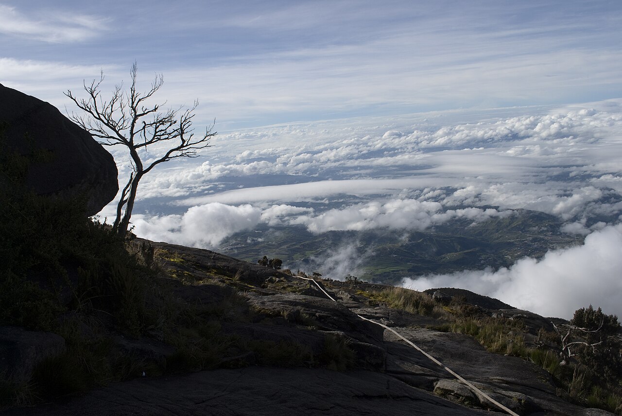
The trail above Panalaban stays rocky before reaching Sayat-Sayat checkpoint at approximately 3,668 metres, where climbing permits are checked. Beyond Sayat-Sayat, the terrain changes completely. The vegetation is gone. You are on bare granite, following fixed ropes up steep slabs in total darkness. Cold, wind, thin air, tired legs from the previous day — this is the hardest section of the entire climb. The fixed ropes are essential: they provide both safety and momentum. The pace is slow and rhythmic. Most climbers settle into a pattern of counting steps between rest breaks and stop thinking about how far remains.
Low’s Peak arrives as dawn is breaking. On clear mornings — common from March through September — the sky turns orange, pink, and gold across the Borneo horizon. Cloud fills the valleys thousands of metres below. On exceptional days, the view extends to the South China Sea and the southern Philippines. Climbers typically spend fifteen to thirty minutes at the summit taking photographs and absorbing what they have done. Then descent begins — back down the fixed-rope granite, through Sayat-Sayat, through the cloud forest, all the way to Timpohon Gate. Allow four to six hours. Trekking poles earn their rental cost on the descent; sustained downhill walking hammers knees and quads in a way the ascent does not.
Via Ferrata: The World’s Highest
Mountain Torq operates the world’s highest via ferrata on Mount Kinabalu — a cable-and-rung route that transforms the standard descent from the summit into a separate and thrilling experience. Two routes are available at different difficulty levels.
Walk the Torq
The introductory route sits at approximately 3,520 metres above sea level. Two to three hours traversing rock faces using fixed steel cables, rungs, and bridges, with dramatic exposure and sweeping mountain views. Minimum age ten, minimum height 1.3 metres. Accessible to fit families with older children who have successfully completed the summit climb. The route crosses the mountain’s upper flanks in a way the standard trail does not, giving a completely different perspective on the summit zone’s granite landscape.
Low’s Peak Circuit
This is the Guinness World Record holder: the world’s highest via ferrata at 3,776 metres above sea level. Four to six hours. The route crosses exposed rock faces on multiple traverses, a suspension bridge at 3,600 metres, and a Nepalese bridge at 3,580 metres. The exposure is serious and altitude makes everything harder and slower than at sea level. Recommended for climbers with above-average fitness and genuine comfort with heights. The climbing itself is not technically demanding — the cables and rungs do most of the work — but the setting is as dramatic as via ferrata gets anywhere on the planet. All via ferrata climbers stay at Mountain Torq’s Pendant Hut above Laban Rata, with dormitory sleeping, sleeping bags, solar-heated showers, and meals included.
Best Time to Climb
The mountain is open year-round. The driest and most reliable window runs from March through September. Rain is less frequent, trail conditions are generally better, and the chances of a clear summit sunrise are significantly higher. October through February sees heavier rainfall, slippier trails, and more cloud at the summit — but also smaller crowds, easier permit availability, and sometimes lower package prices.
Kinabalu’s weather is inherently unpredictable regardless of season. Even during the driest months, cloud can roll in at any time and some climbers reach Low’s Peak to find nothing but white. Prepare mentally for that possibility and treat clear views as the bonus rather than the guaranteed outcome — the summit experience holds its value regardless of visibility. The coldest conditions occur in March and April, when summit temperatures can drop below minus five degrees Celsius. Peak permit demand coincides with Malaysian school holidays — Chinese New Year, Hari Raya, and the June to August mid-year break. Weekdays outside holiday windows offer the best combination of permit availability, smaller trail crowds, and manageable base camp congestion.
Practical Tips
Getting there: Kinabalu Park is ninety kilometres from Kota Kinabalu — roughly two hours by road. Most climbing packages include return transfers from the city. Kota Kinabalu is served by multiple daily flights from Kuala Lumpur on AirAsia and Malaysia Airlines (approximately 2.5 hours), plus direct international flights from Singapore, Seoul, Taipei, and several Chinese cities.
Travel insurance: Confirm your policy covers trekking above 4,000 metres — many standard travel policies exclude this altitude. Check specifically for emergency helicopter evacuation coverage, which is expensive if you need it and worth having.
Photography: Bring a camera or phone with good low-light capability for the summit sunrise. Keep spare batteries in an inner pocket — cold drains them fast. A lightweight gorilla pod allows longer exposure shots of the pre-dawn sky without carrying a full tripod.
Recovery: Plan a full rest day after the climb. Delayed onset muscle soreness peaks around forty-eight hours post-descent and makes descending stairs genuinely painful. The Poring Hot Springs within Kinabalu Park — naturally heated mineral pools plus a forest canopy walkway — are the classic recovery stop and worth building into your itinerary.
Cultural respect: Mount Kinabalu is a sacred site for the indigenous Kadazan-Dusun people of Sabah. Follow your guide’s instructions, stay on marked trails, carry all waste down with you.
Certificate of completion: Completing the climb earns an official Sabah Parks certificate of achievement noting whether you reached Laban Rata or the full summit at Low’s Peak. A tangible souvenir of a real accomplishment.
Guides and group size: The compulsory guide-to-climber ratio is typically one guide per six climbers. Solo travellers and couples are usually paired with other climbers who have the same assigned guide — this is normal practice and the guides manage multi-nationality groups smoothly. Private guide arrangements are available at higher cost and worthwhile if you want a personalised pace and detailed commentary on the biodiversity along the trail. Guides are Kadazan-Dusun locals with deep knowledge of the mountain. Many climbers find that conversations with their guide during the rest breaks on day one become one of the more memorable parts of the trip.
Porters: Porters are available to hire at park headquarters for those who want to carry a lighter daypack on the climb. The standard load per porter is around ten to fifteen kilograms. Hiring a porter reduces physical strain significantly — worthwhile for less confident climbers, older travellers, or anyone adding via ferrata who needs to conserve energy. The porter service is operated by local Kadazan-Dusun community members, and the fee goes directly to the local economy.
Trail Conditions and What to Expect on Each Section
Knowing what the trail surface is like at each stage helps you pace yourself correctly and pack the right footwear. The climb divides roughly into three distinct terrain types, each with its own demands.
Lower Trail: Timpohon Gate to Kilometre 4 (1,866m to ~2,600m)
The lower trail is the longest section and runs through tropical montane and lower cloud forest. The path is well-maintained with a combination of packed earth, wooden boardwalks across muddy stretches, and stone steps on the steeper sections. Tree roots cross the trail frequently and can be slippery when wet. The canopy provides shade for much of this section, which helps with temperature management during the warmer midday hours. Rest shelters with basic toilets appear approximately every kilometre. This is where most people set their pace for the day — resist the temptation to go fast early. The trail gets harder, not easier, as you ascend.
Middle Trail: Kilometre 4 to Panalaban (approx. 2,600m to 3,270m)
Above kilometre four, the mossy cloud forest gives way to increasingly sparse and stunted vegetation. The trail becomes rockier — more boulder scrambling and fewer wooden steps — and the exposure increases on some sections where the trail crosses open ground. Wind can be a factor on exposed ridges in this zone. The final approach to Panalaban involves a series of steeper pitches before the base camp plateau comes into view. This section is where altitude begins to tell, and where AMS symptoms most commonly appear. The kilometre markers here feel further apart than they did below.
Summit Zone: Sayat-Sayat to Low’s Peak (3,668m to 4,095m)
The summit zone above Sayat-Sayat is a different world from everything below it. Bare granite slabs, fixed ropes, and near-zero vegetation. In darkness and cold this section demands focus. The ropes are well-maintained and clearly route the way even without good visibility. The rock is grippy when dry and significantly more treacherous when wet or icy. Rain gear and good boot grip are important for safety here. The gradient is steep but not technically difficult — every section is manageable if you move slowly and use the ropes correctly. The final push to Low’s Peak involves a short, steep scramble over large granite boulders to reach the summit marker.
Is Climbing Mount Kinabalu Worth It?
The honest answer is yes — for the right person. If you are willing to prepare physically, commit to the permit booking process months in advance, and accept that the summit conditions might not deliver the clear sunrise you imagined, Kinabalu delivers an experience that most people who do it rank among the highlights of their Southeast Asian travels. The combination of extraordinary biodiversity on the trail, the social atmosphere at Laban Rata, the physical challenge of the pre-dawn push, and the summit view on a clear morning creates something that is greater than the sum of its parts.
The cost is the main hesitation most people raise. RM2,690 to RM2,890 for an all-inclusive international package is not cheap by Malaysian standards, and it is significantly more than most other adventure activities in the country. But it is a fraction of what a comparable high-altitude trekking experience in Nepal, Patagonia, or East Africa would cost, and the all-inclusive nature of the packages — transport, accommodation, meals, guide, and permit in one booking — removes most of the logistical complexity. The certificate you collect at park headquarters on the way out, certifying a Low’s Peak summit, is one of the few adventure travel souvenirs that actually means something.
For those who prefer not to climb but still want to experience the mountain, the Kinabalu Park headquarters area at 1,500 metres offers botanical gardens, excellent birdwatching, and short forest trails that showcase the park’s biodiversity without any altitude demands. Day visitors and non-climbing companions can have a genuinely rewarding time here while climbers are on the mountain. The Mesilau Nature Resort on the eastern side of the park provides an alternative entry point for acclimatisation walks and the less-trafficked Mesilau Trail, which some climbers use as an alternative first-day route that is slightly longer but passes through different forest types including rhododendron heath forest.
Extending Your Sabah Adventure
Kinabalu is often the centrepiece of a longer Sabah itinerary, and the state rewards the extra time. After a recovery day at Poring, most people head east to the coast. Semporna is the gateway to Sipadan and the dive sites — our full scuba diving malaysia guide covers everything in detail, but Sipadan consistently ranks among the top five dive sites on Earth and is worth the logistics. For non-divers, snorkeling in malaysia at the shallower reefs around Semporna’s islands — Mataking and Pom Pom in particular — delivers exceptional visibility without any certification.
If you have a day or two in Kota Kinabalu before or after the climb, the Kiulu River offers easy white water rafting malaysia for families and beginners — Class I to II in scenic countryside an hour from the city. The Tunku Abdul Rahman Marine Park gives you snorkelling and sea kayaking within a short boat ride of the city centre.
For those continuing to Peninsular Malaysia after Sabah, the adventure options expand further. Gopeng in Perak pairs Kampar River rafting with caving in malaysia at Gua Tempurung on the same day trip from KL. Taman Negara offers the flagship jungle trekking malaysia experience — multi-day trails through primary rainforest estimated at over 130 million years old, a world-class canopy walkway, and the best large mammal spotting on the peninsula. Mount Kinabalu anchors one end of the most rewarding adventure circuit in Malaysia, and the rest of the country is well set up to deliver whatever comes after it.
2 notes